Sabratah (Şabrātah)
Sabratha (صبراتة; also Sabratah, Siburata), in the Zawiya District of Libya, was the westernmost of the ancient "three cities" of Roman Tripolis, alongside Oea and Leptis Magna. From 2001 to 2007 it was the capital of the former Sabratha wa Sorman District. It lies on the Mediterranean coast about 70 km west of modern Tripoli. The extant archaeological site was inscribed as a UNESCO World Heritage Site in 1982.
Sabratha's port was established, perhaps about 500BCE, as the Phoenician trading-post of Tsabratan (,, or ??????, ). This seems to have been a Berber name, suggesting a preëxisting native settlement. The port served as a Phoenician outlet for the products of the African hinterland. Greeks called it also Abrotonon (Ἀβρότονον). After the demise of Phoenicia, Sabratha fell under the sphere of influence of Carthage.
Following the Punic Wars, Sabratha became part of the short-lived Numidian kingdom of Massinissa before this was annexed to the Roman Republic as the province of Africa Nova in the 1st century BC. It was subsequently romanized and rebuilt in the 2nd and 3rd centuriesCE. The Emperor Septimius Severus was born nearby in Leptis Magna, and Sabratha reached its monumental peak during the rule of the Severans, when it nearly doubled in size. The city was badly damaged by earthquakes during the 4th century, particularly the quake of 365. It fell under control of the Vandal kingdom in the 5th century, with large parts of the city being abandoned. It enjoyed a small revival under Byzantine rule, when multiple churches and a defensive wall (although only enclosing a small portion of the city) were erected. The town was site of a bishopric. Within a hundred years of the Muslim invasion of the Maghreb, trade had shifted to other ports and Sabratha dwindled to a village.
Map - Sabratah (Şabrātah)
Map
Country - Libya
 |
 |
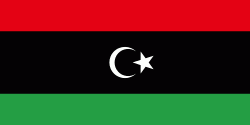
| Flag of Libya | |
Libya has been inhabited by Berbers since the late Bronze Age as descendants from Iberomaurusian and Capsian cultures. In classical antiquity, the Phoenicians established city-states and trading posts in western Libya, while several Greek cities were established in the East. Parts of Libya were variously ruled by Carthaginians, Persians, and Greeks before the entire region becoming a part of the Roman Empire. Libya was an early center of Christianity. After the fall of the Western Roman Empire, the area of Libya was mostly occupied by the Vandals until the 7th century when invasions brought Islam to the region. In the 16th century, the Spanish Empire and the Knights of St John occupied Tripoli until Ottoman rule began in 1551. Libya was involved in the Barbary Wars of the 18th and 19th centuries. Ottoman rule continued until the Italo-Turkish War, which resulted in the Italian occupation of Libya and the establishment of two colonies, Italian Tripolitania and Italian Cyrenaica (1911–1934), later unified in the Italian Libya colony from 1934 to 1943.
Currency / Language
| ISO | Currency | Symbol | Significant figures |
|---|---|---|---|
| LYD | Libyan dinar | لد | 3 |
| ISO | Language |
|---|---|
| AR | Arabic language |
| EN | English language |
| IT | Italian language |


